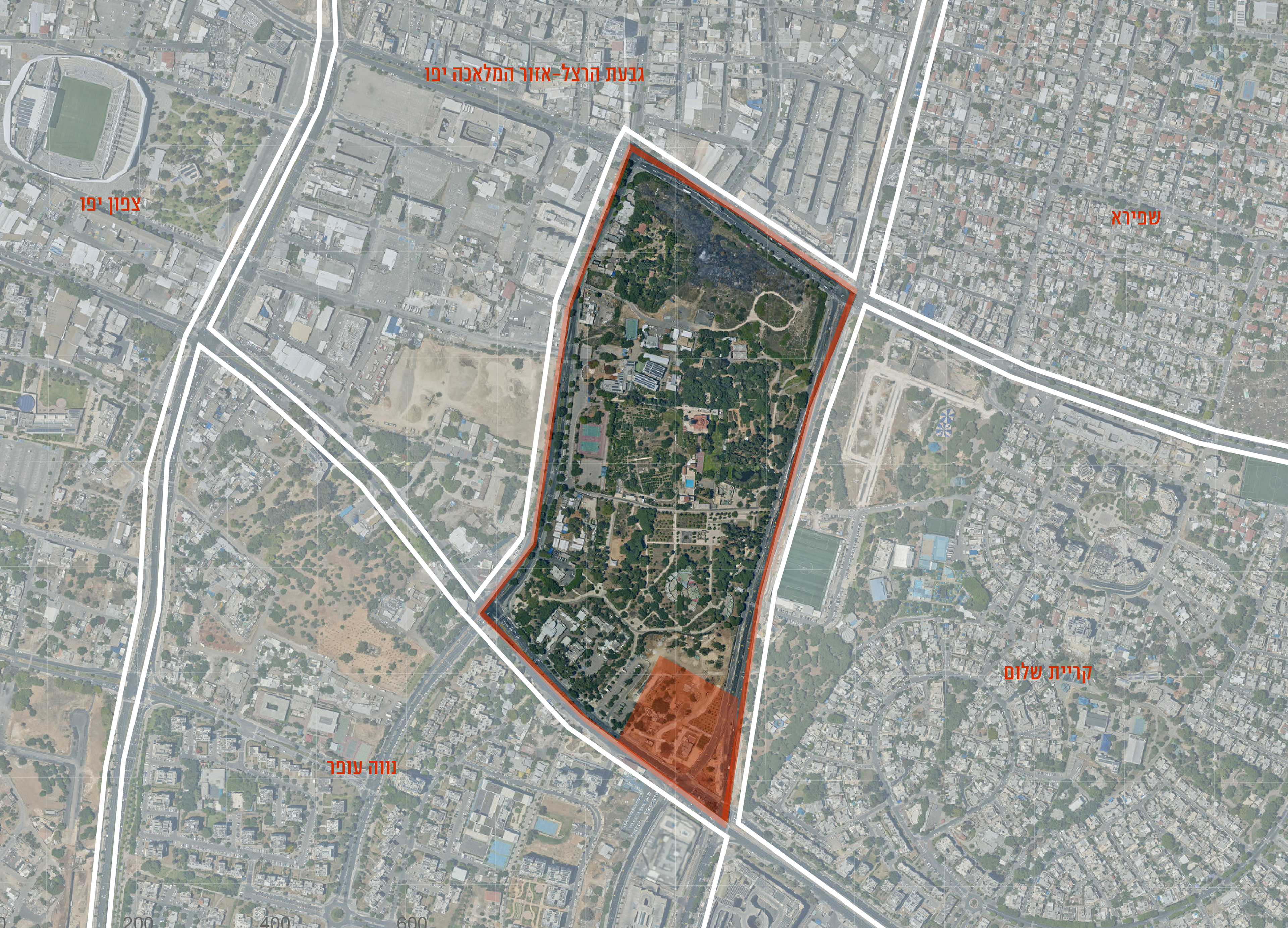
SETTLEMENT
At the selected area in Abu Kabir, we chose to settle in Sankat Al Turki, because of its proximity to the historic Jerusalem Road (today's Ben Zvi Road) and because of the well house and the remains of the buildings that still remain there.
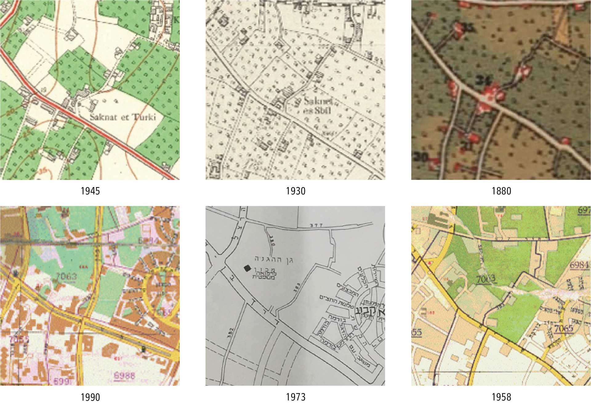
HISTORICAL MAPS
Sandel's early map from 1880 already shows the presence of the hazard and several individual buildings nearby. In the British maps, there is also a record of the danger. In the plans of the Department of Surveys made after 1948, it can be seen that they omitted the presence of the buildings and their appearance again on the map from 1990.
One of the prominent elements throughout all the maps and results is the path that cuts through the danger and connects it to the historical road.
BEIT HABER | Palestinian settlement
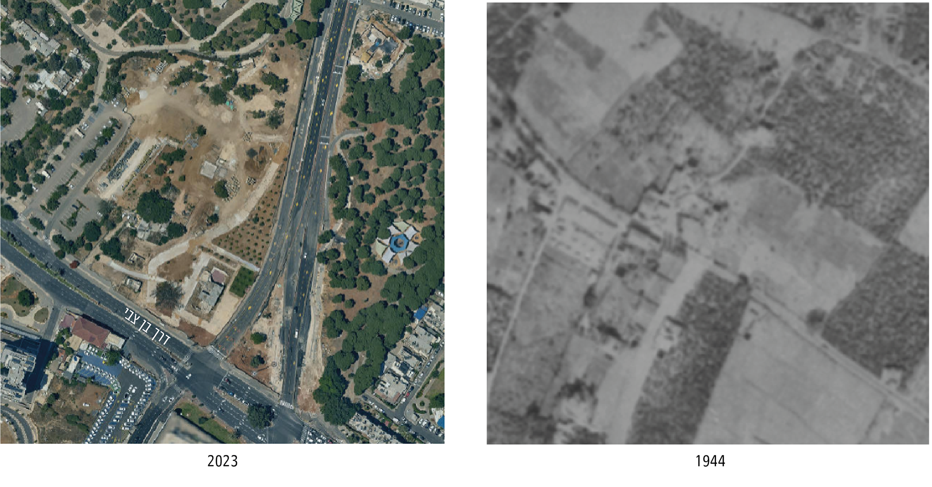
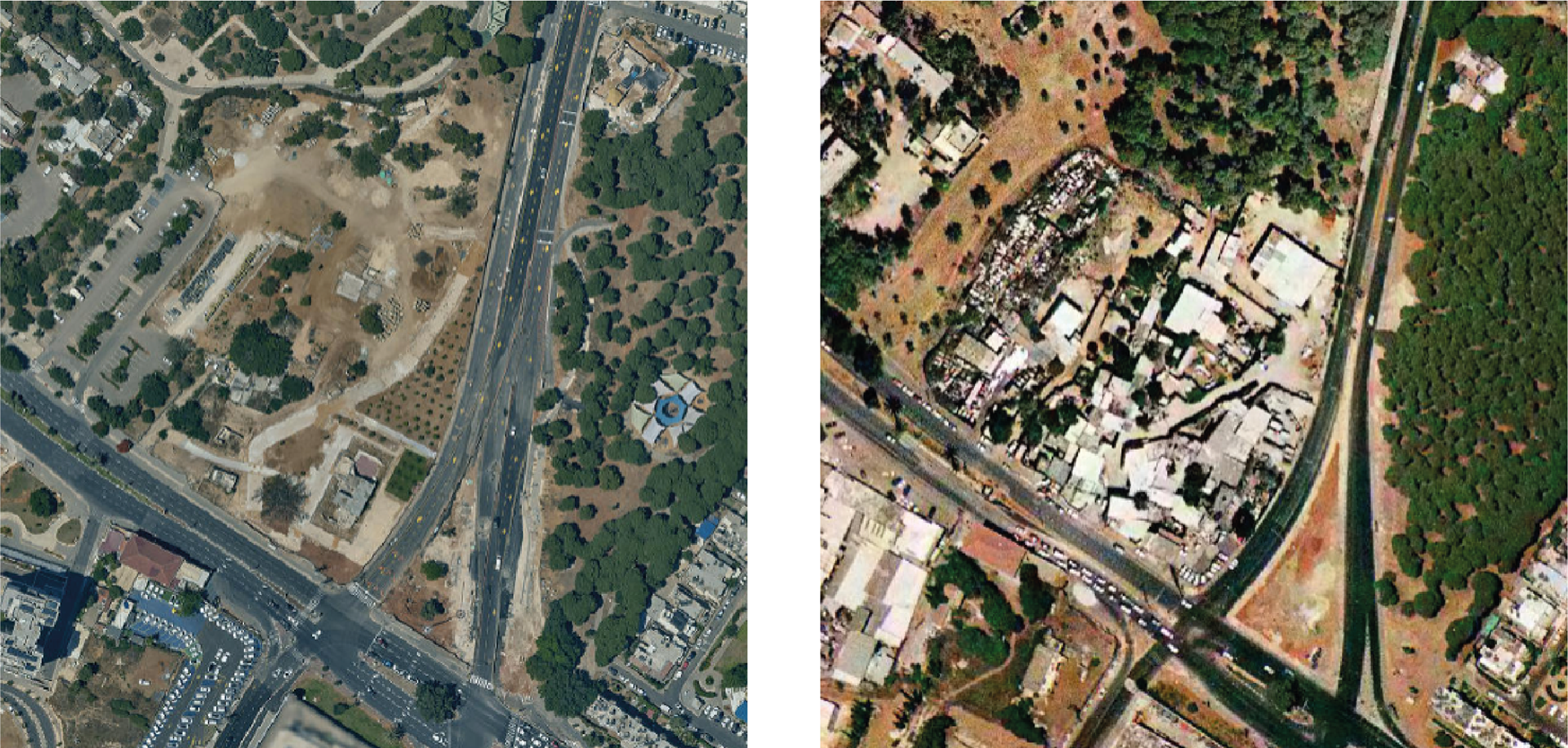
Comparing the results before 48 and the current situation, one sees that the road that crosses the danger is cut off and splits the danger into two sides - one of the buildings near the historic road and a single well house on the new Pinchas Levon road.
BEIT HABER | Settlement of Jewish immigrants
Israel from 1997 where you can still see the residences of the Persian immigrants who lived there until the evacuation of the danger 5 years ago. You can see the construction additions next to the buildings and on them in front of the situation today.
The starting point that has been correct until today is that there was a danger in the area, which is further documented on the Sandal map as a Sabil danger and a Turkish danger. Looking at the results and the maps against the existing situation raised questions about the lack of documentation and additional information about the danger. The danger buildings are characterized by a typology of mud construction, the existing buildings are built of limestone similar to the well house, an element that probably indicates an error in reading the buildings as a danger.
BEIT HABER | Settlement of Jewish immigrants BEIT HABER | Palestinian settlement
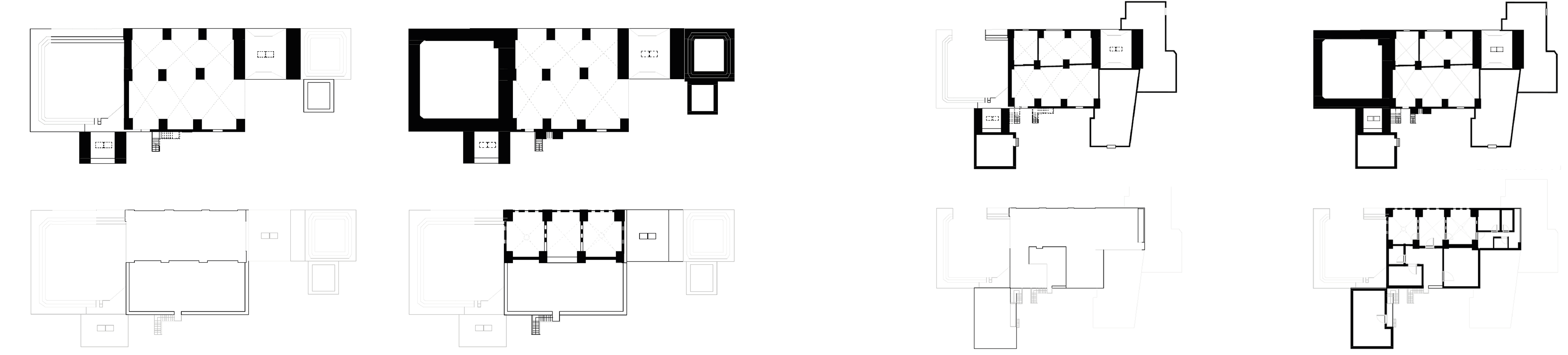
BEIT HABER | existing condition
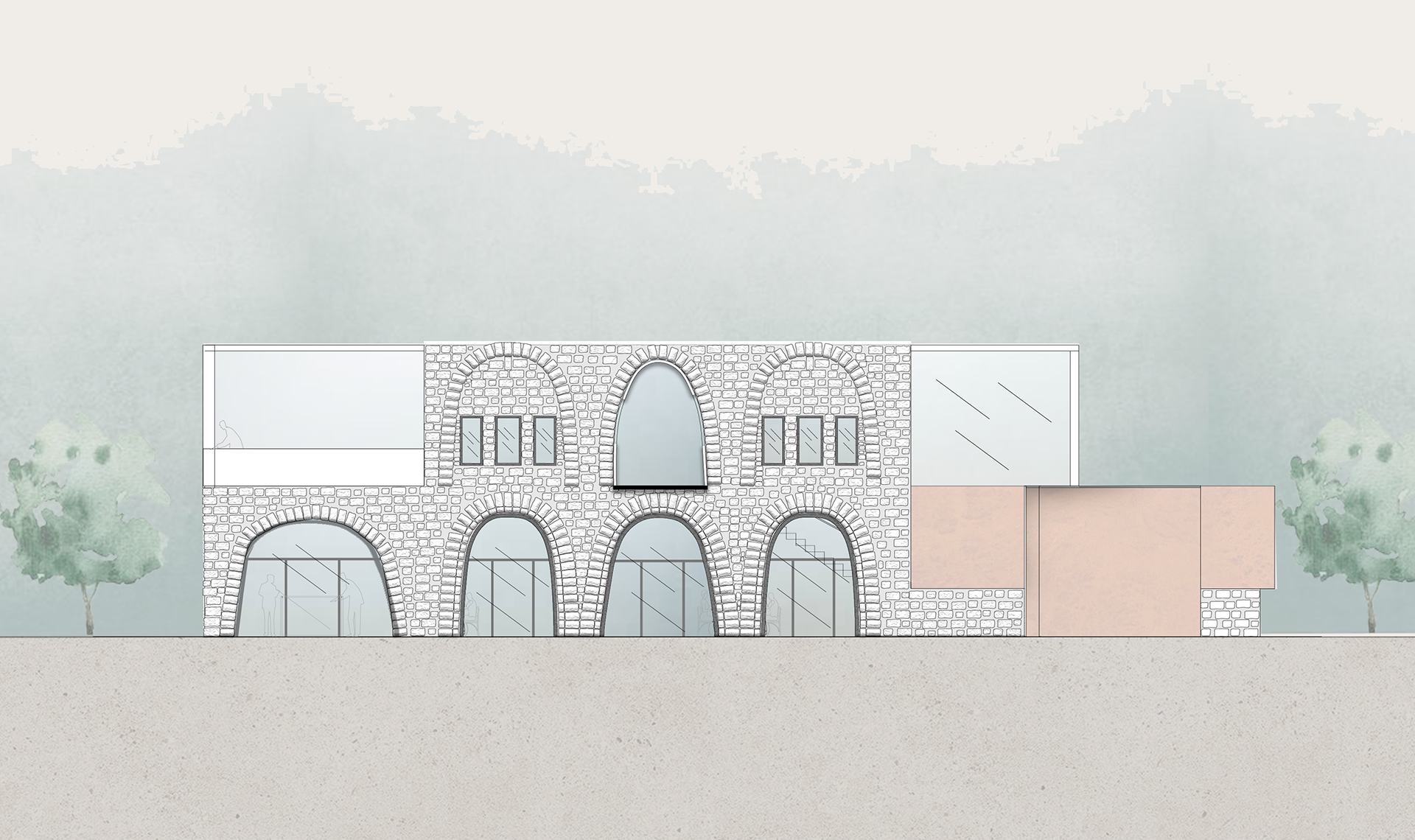
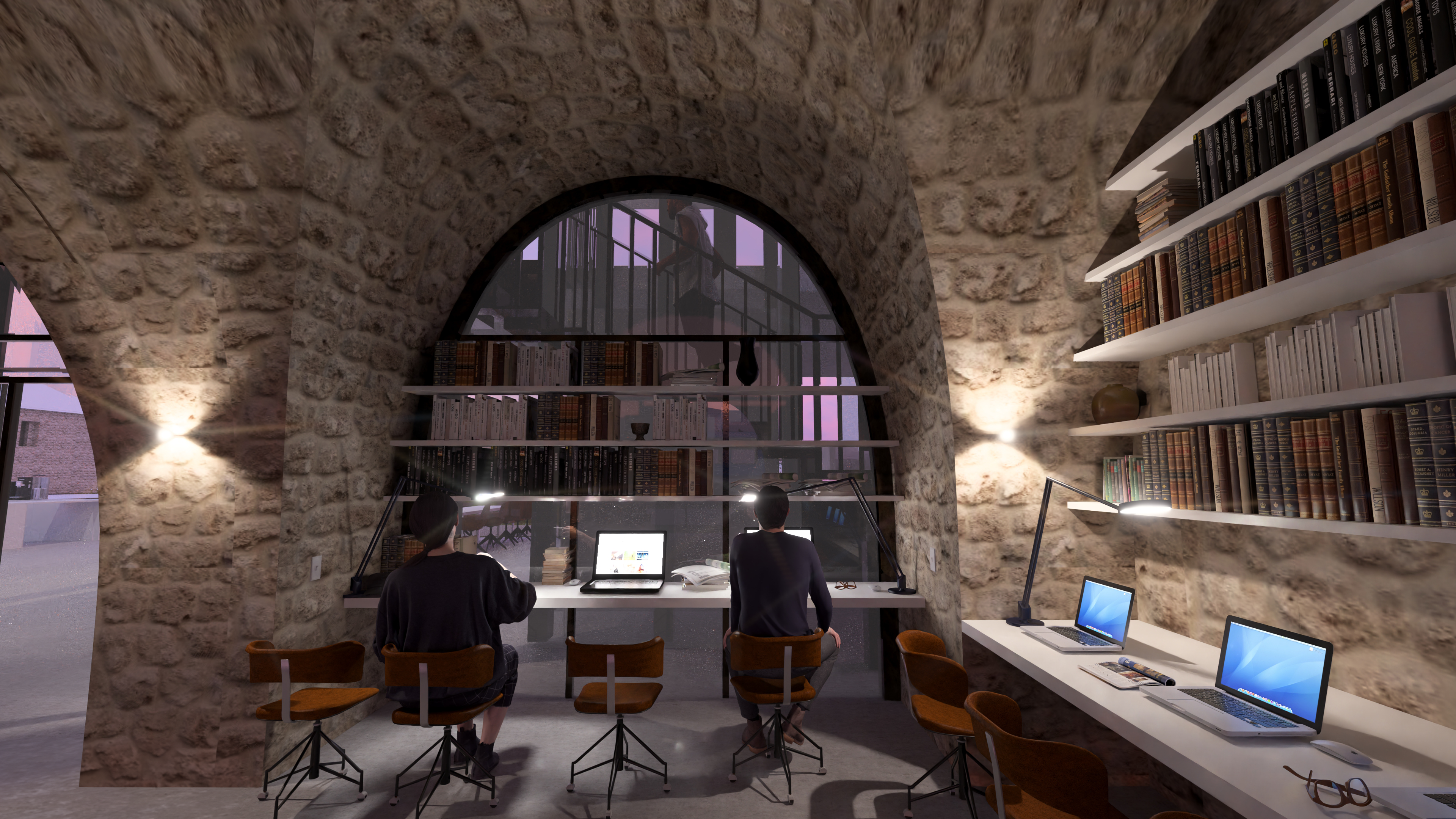
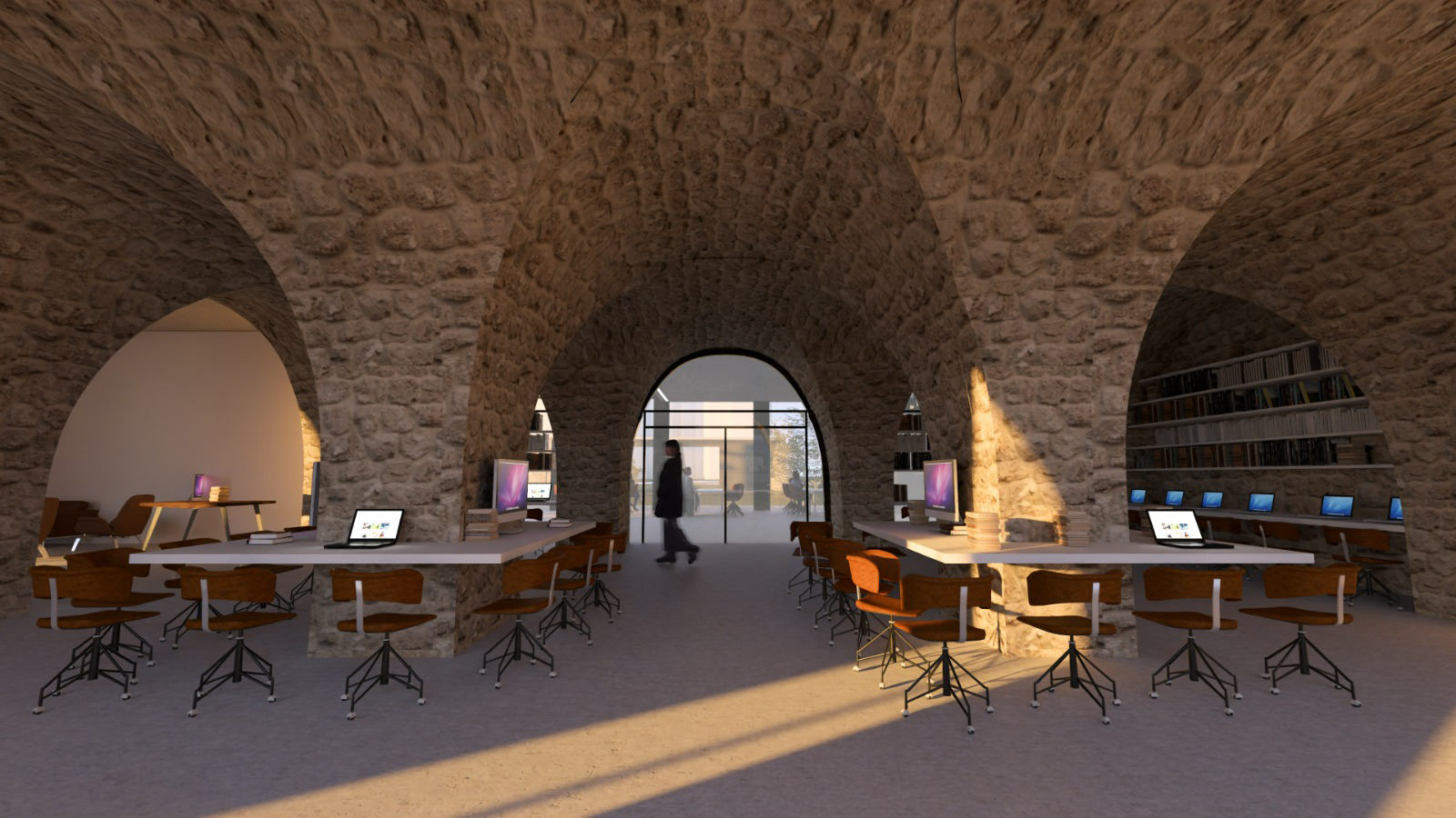
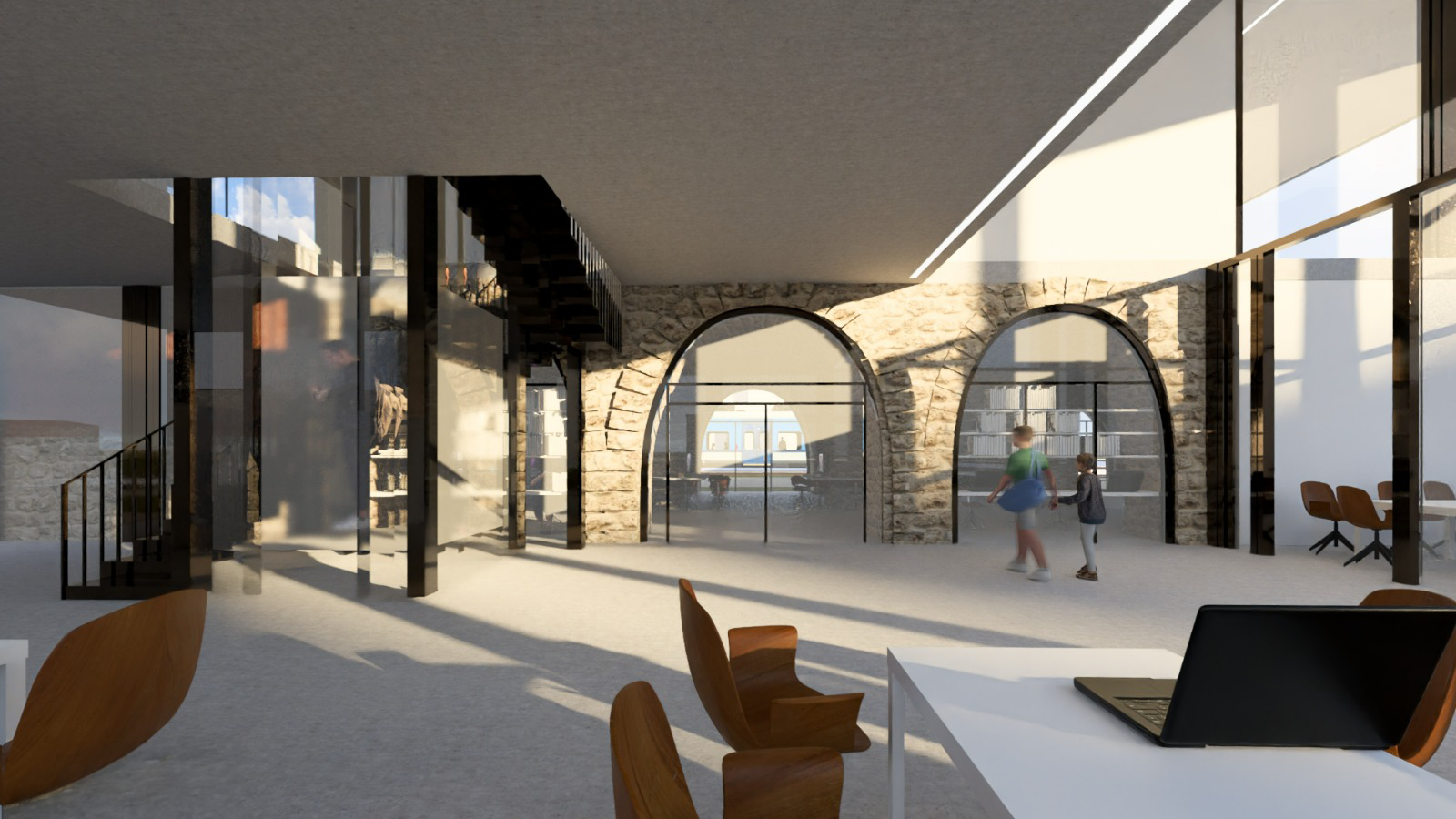
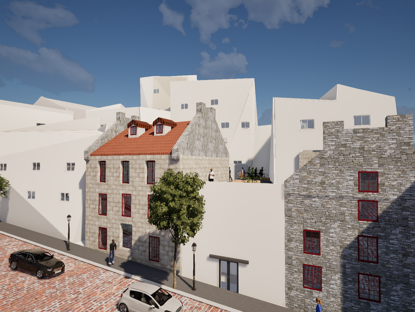
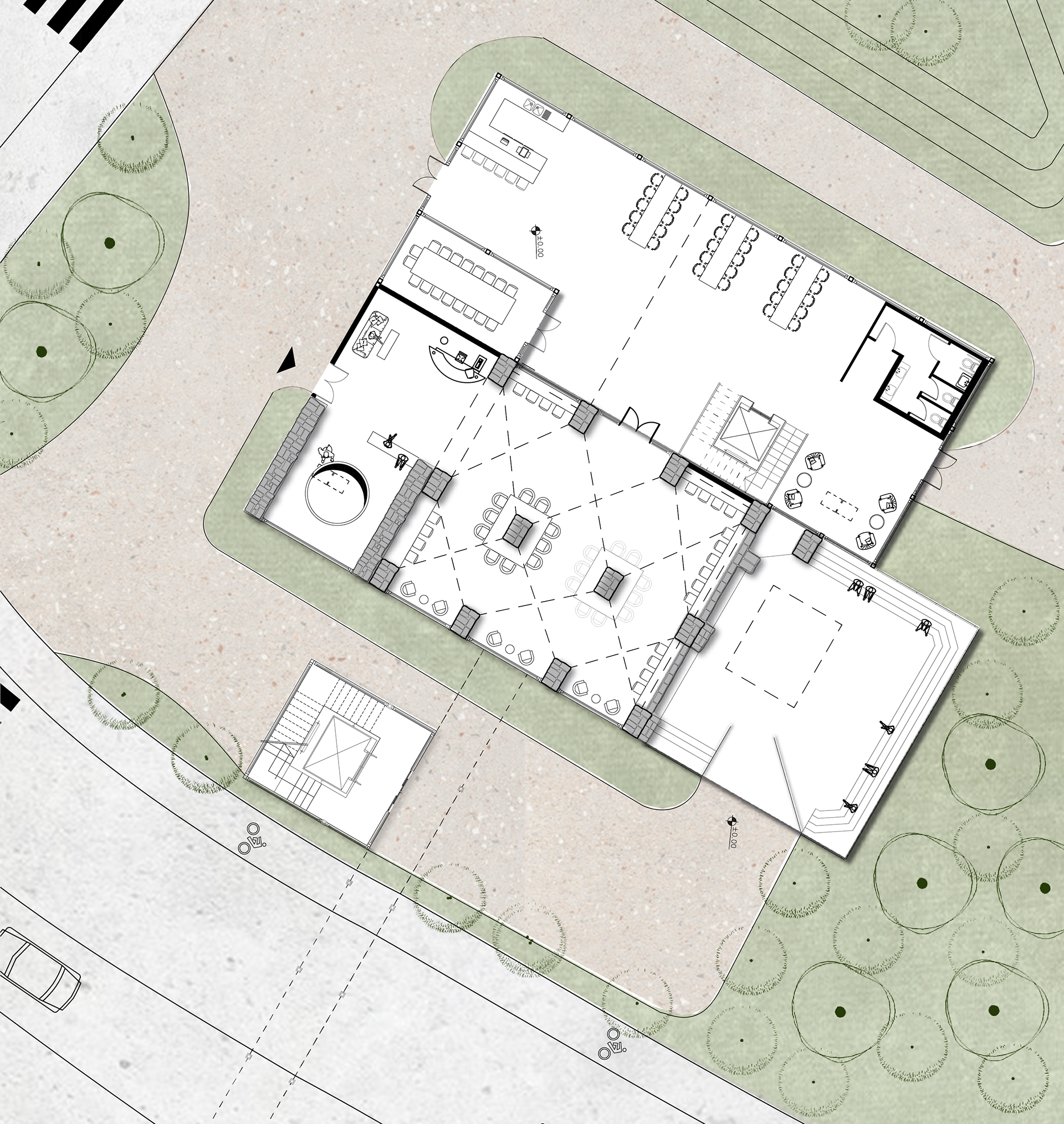
The main building in the area is relatively well preserved Characterized by the construction typology of a central space house, with 2 floors A well is located next to the residence and next to it is a small storage pond and a regulating pond External stairs at the back of the building lead to the first floor.
Over the years, the building underwent internal division and part of the barakah was destroyed. New rear additions were also erected on the first floor.
PROGRAM
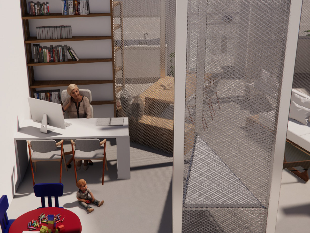
Sanat Al-Sabeel is a place that has undergone a double trauma, first due to the expulsion of the Palestinian founders and then, the expulsion of the Persian immigrants. Today the site is abandoned and destroyed. There are only a few buildings left in it, which the municipality also plans to demolish. "The Greatest Place" a book written by the sociologist Ray Oldenberg, refers to the third place, which is not the first place (place of residence) or the second (place of work).
The third place, describes a place where people can voluntarily stay, participate in non-public conversations, to share ideas and build relationships. If so, "third places", are the "anchors" of the community. We see a third place as a cultural and artistic space as the main motive that can give a platform to the history of the place and present the trauma and in addition respond to today's needs.
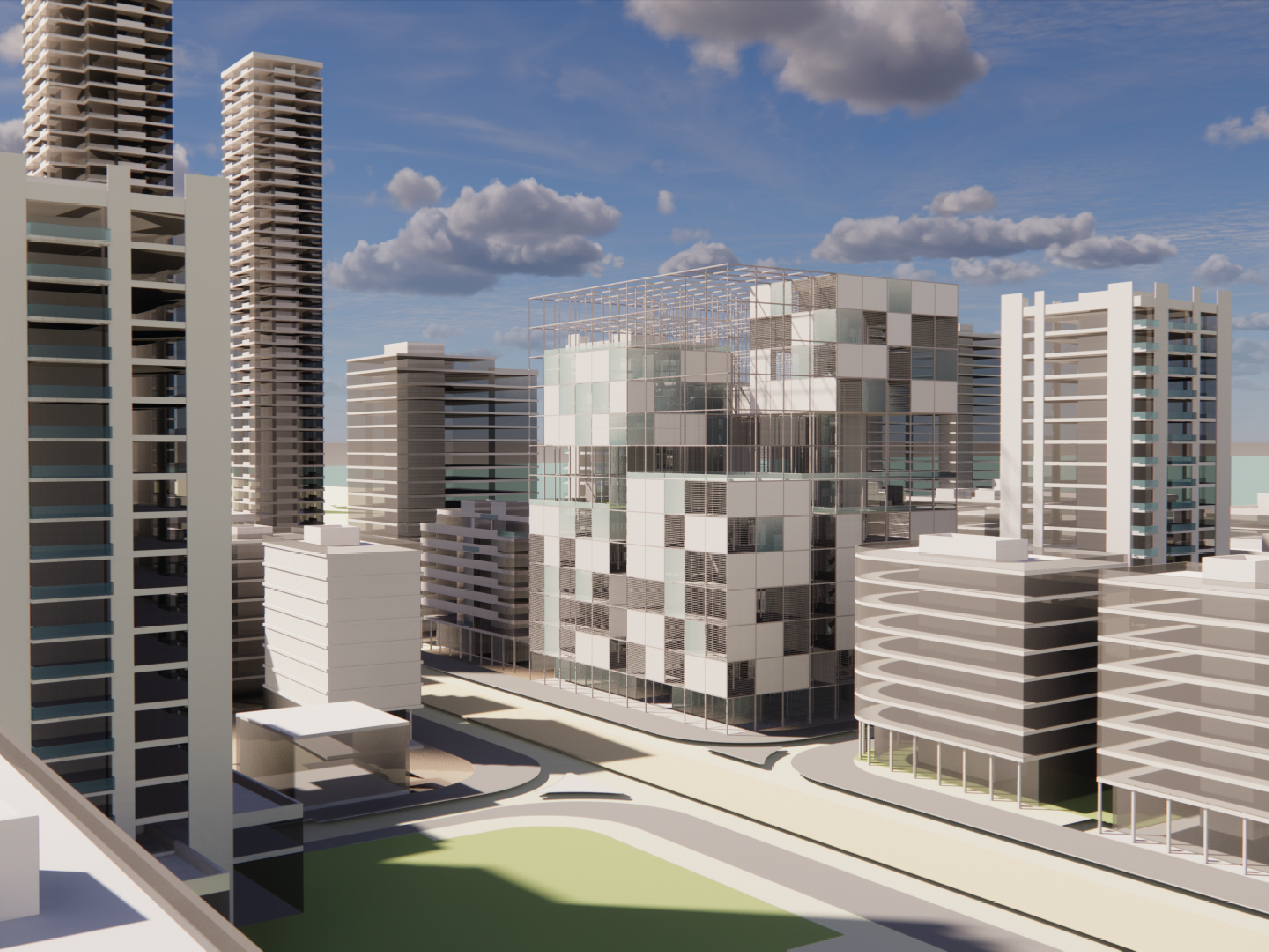
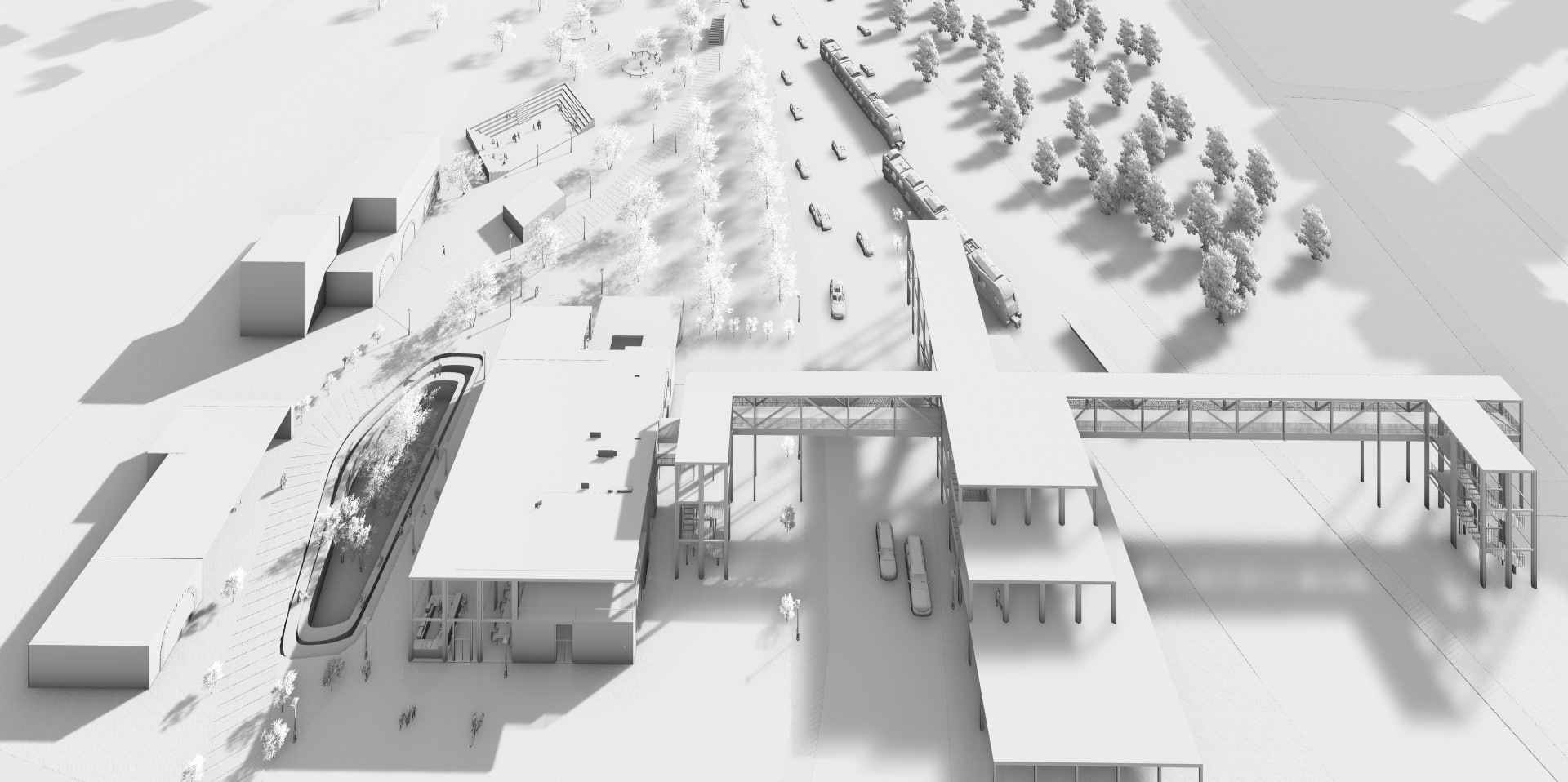
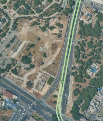
THR GREEN LINE | Abu Kabir station
The green line of the light rail is expected to pass through the Abu Kabir junction. When the line station is Elite, and the station is between the 2 train lines.
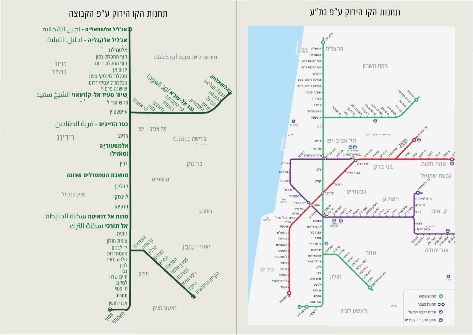
THR GREEN LINE | the line stations
According to the NTA, the train goes from Herzliya, through Tel Aviv and ends in Rishon Lezion. The station of the line is called in different places according to Neta, sometimes as the Factory Park and sometimes as Kabir Kabir. This point indicates the emission of a pen, we mapped all the train stations that overlap areas of embarrassment.
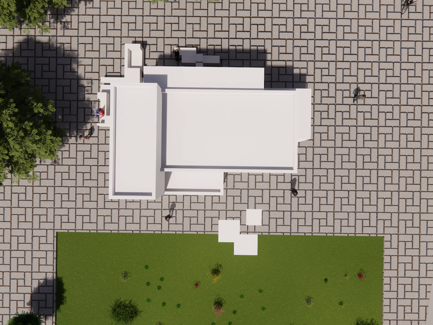
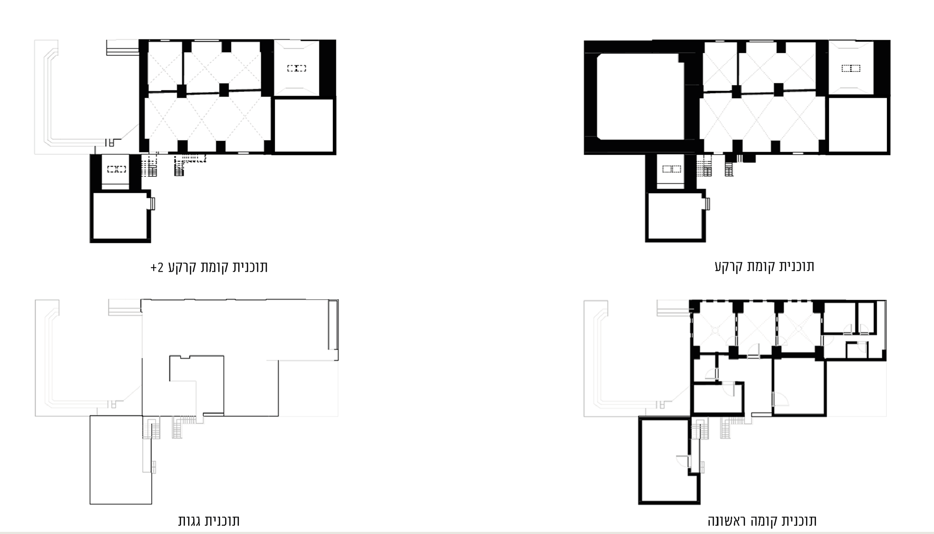
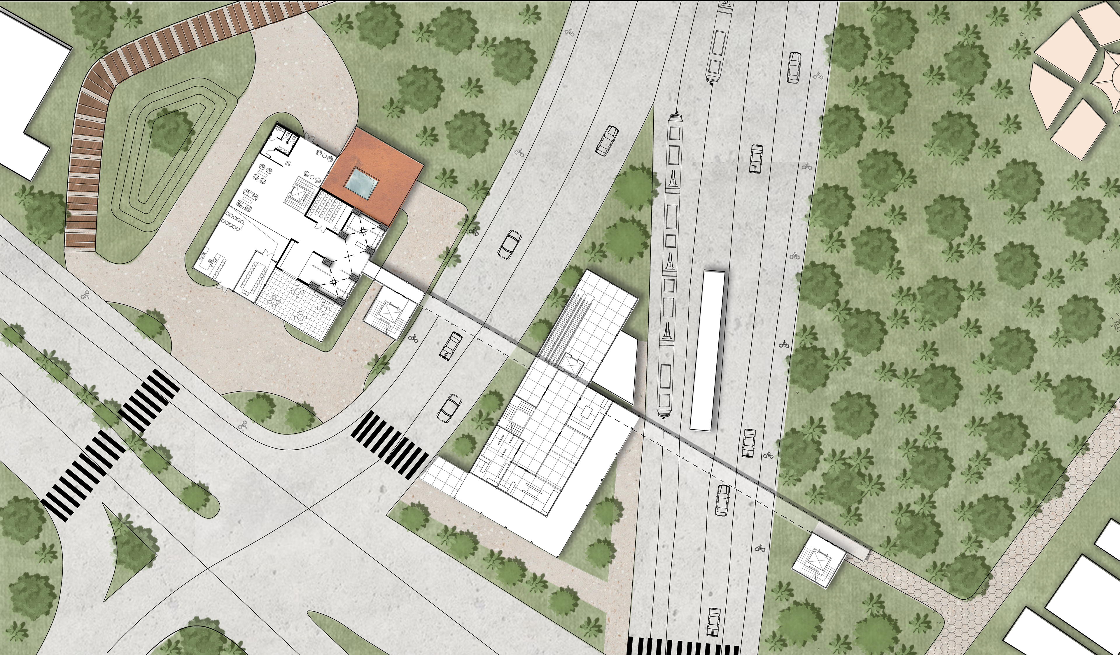
SITE PLAN | 1:1000
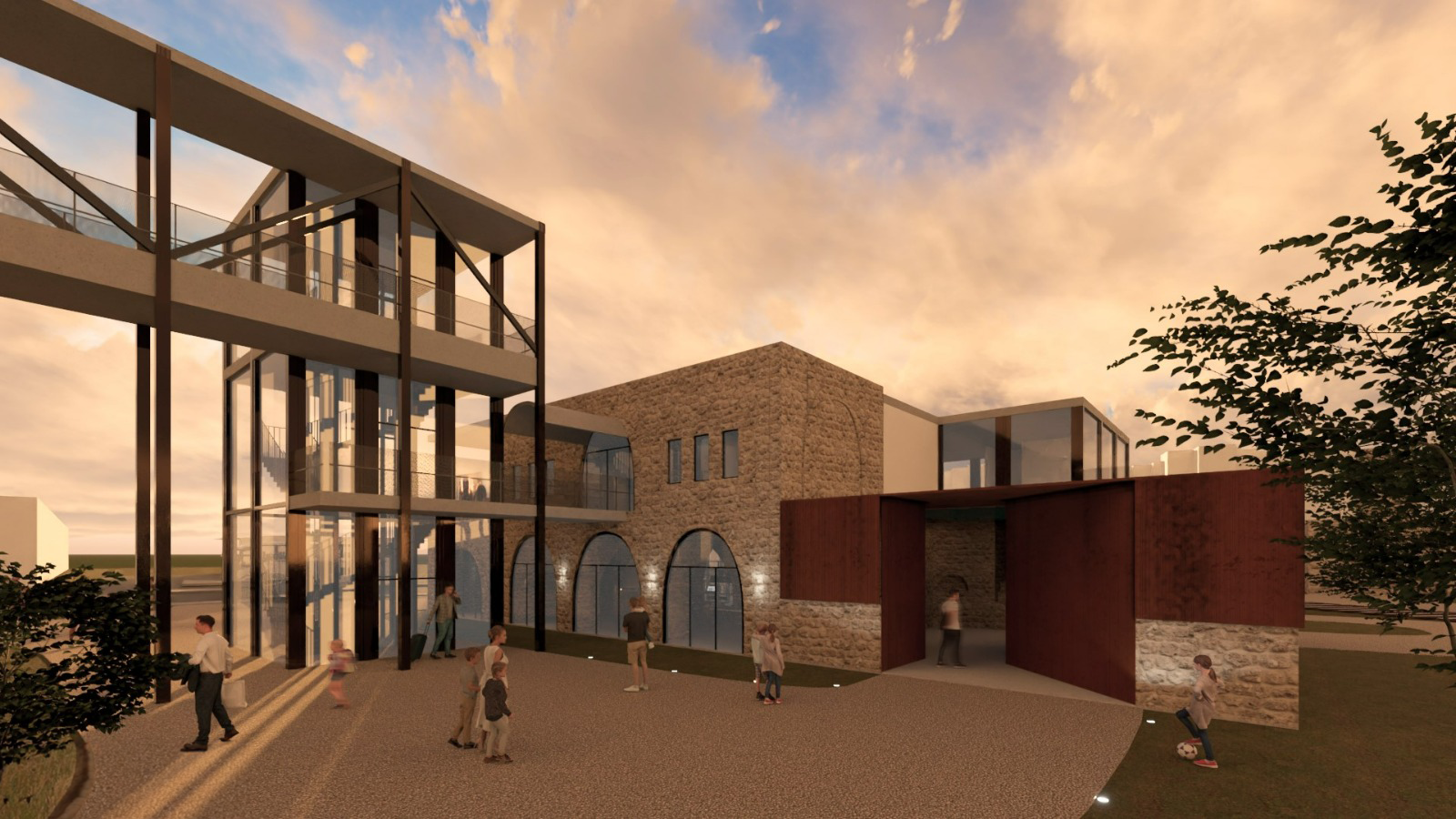
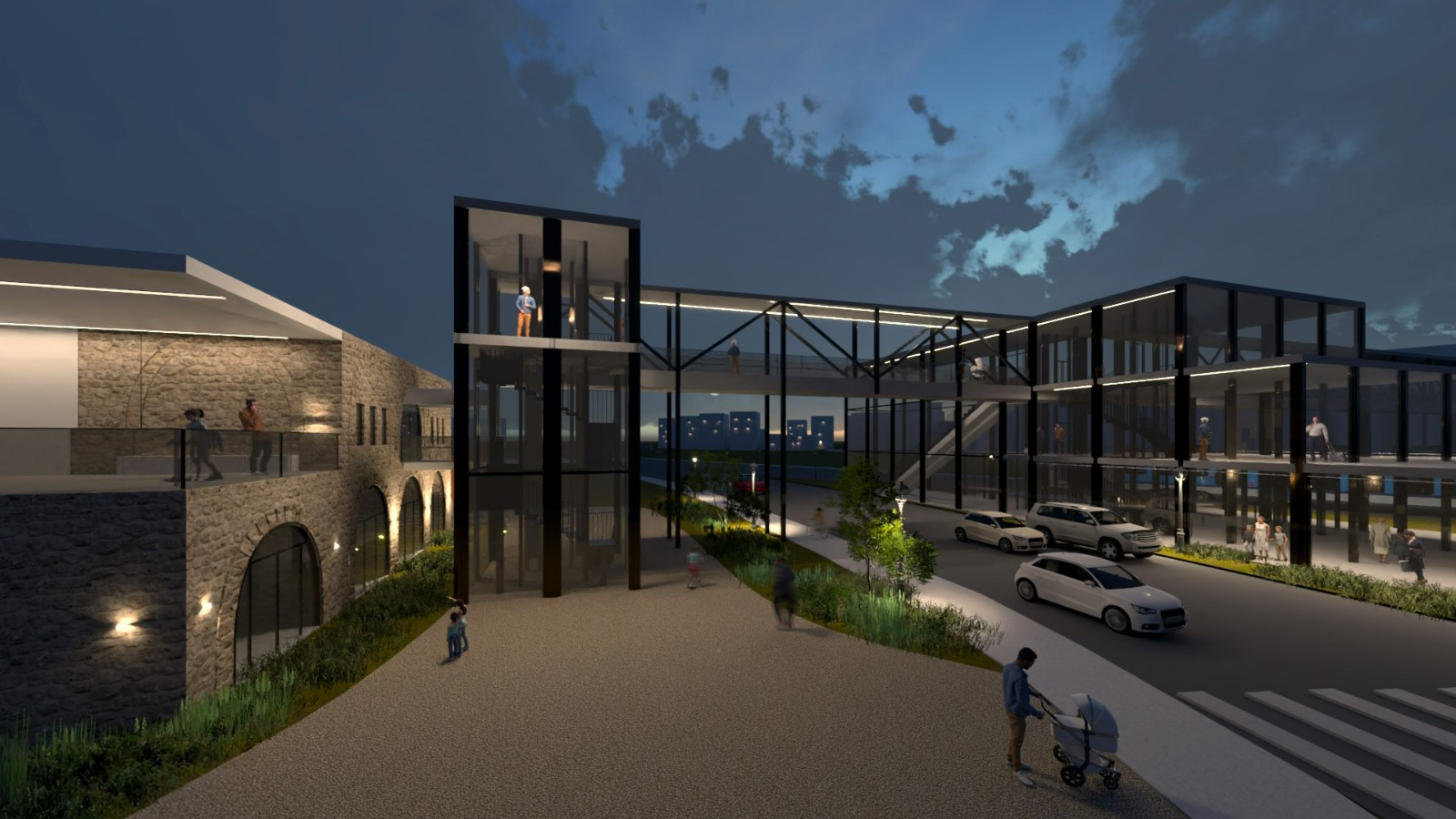
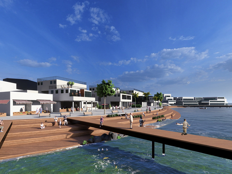
The existing buildings and the new construction connected to them the program offers a cultural complex that connects to the new light rail station, through a physical connection of a bridge into the well house. Connection to the groves park and reference to the historical road (Jerusalem Road)
The bridge crosses the commercial center to the other side of the road through a vertical traffic system that descends to the street level and connects to the Kiryat Shalom neighborhood.
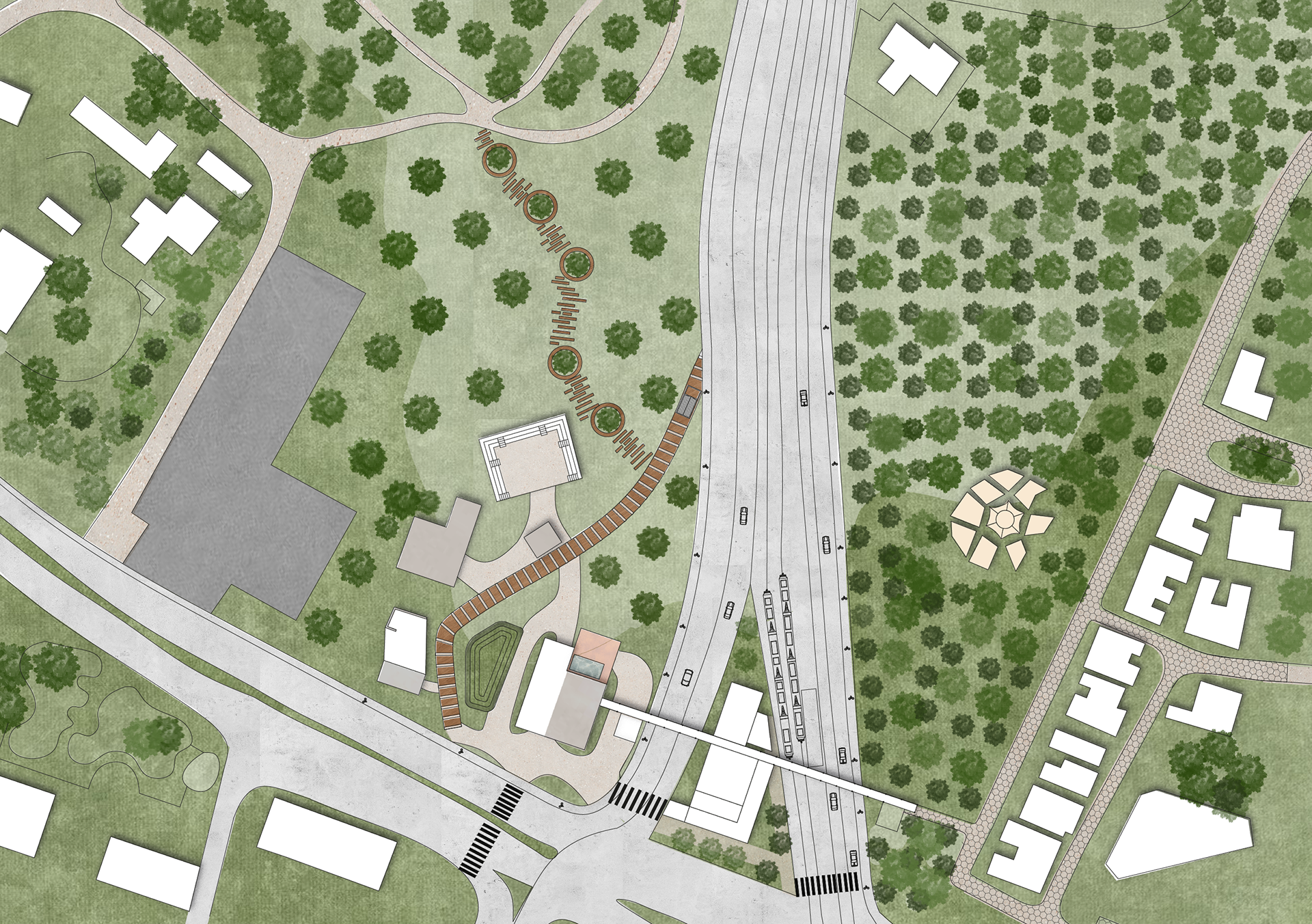
SITE PLAN | 1:500
The planning focuses on the main well house, which connects via a bridge to a commercial center and the new station
AL-TURKI STATION PLAN
Ground level | 1:250
Moving from the waiting area of the station toa commercial complex with stands for independent sale, a catering complex and a covered terrace. Going up to the second floor to the bridge using escalators and an elevator. We chose to build a steel and glass standing construction in order to allow sight and views of the well house opposite and the Sanat
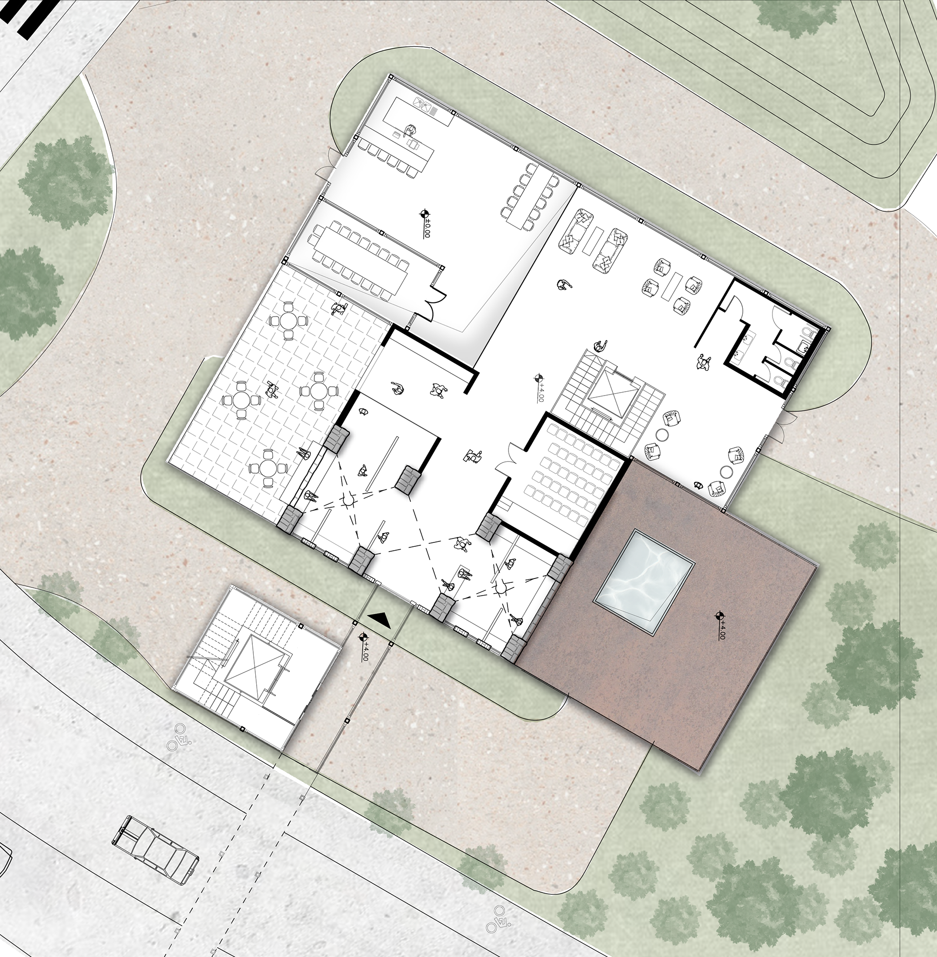
AL-TURKI STATION PLAN
first floor| 1:250
Two commercial floors, the second floor connects to the bridge and each floor is set back from the floor below.
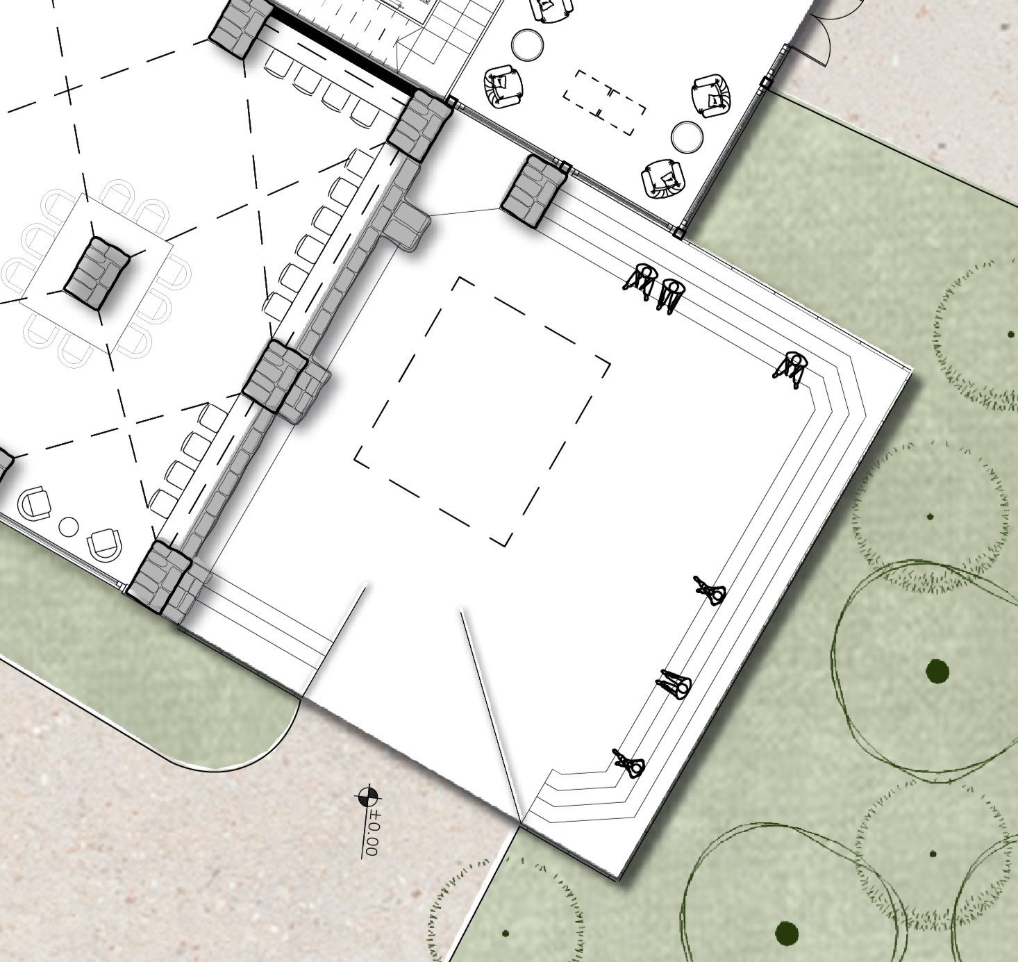
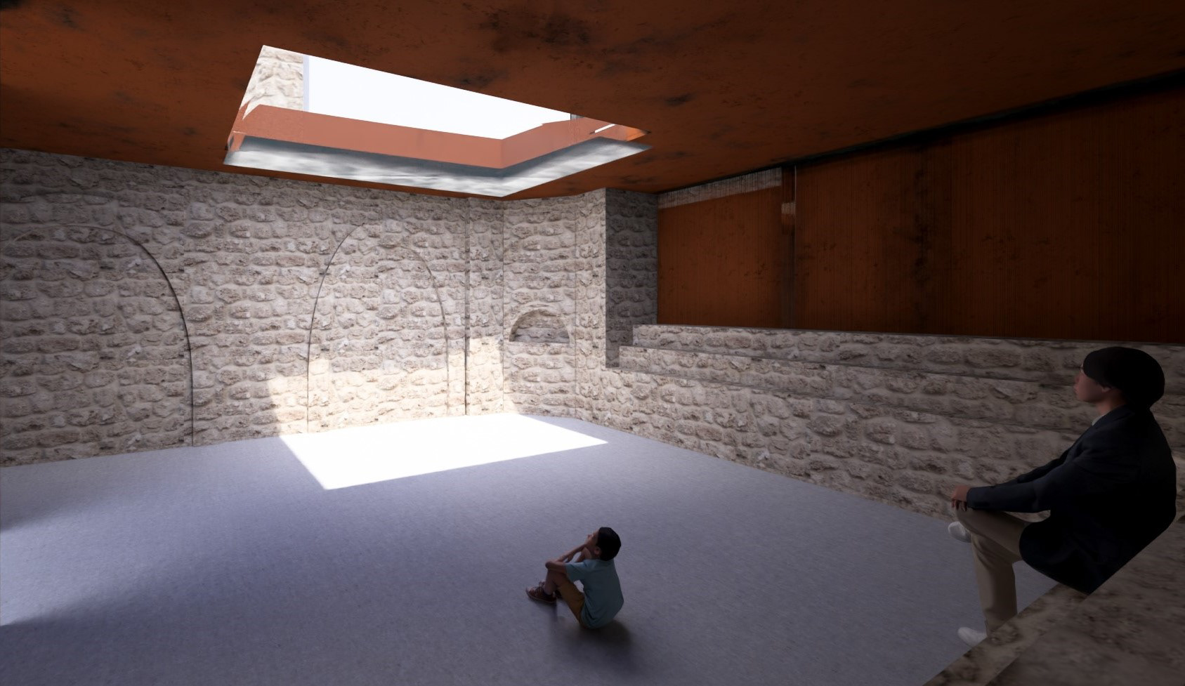
A-SABIL POOL
The space was designed with the aim of creating an atmosphere that emphasizes the "empty" Planning principles:
1. Material dissonance
2. Spotlight entry
3. Reference to the historical pool
4. An entrance that emphasizes the existing fracture
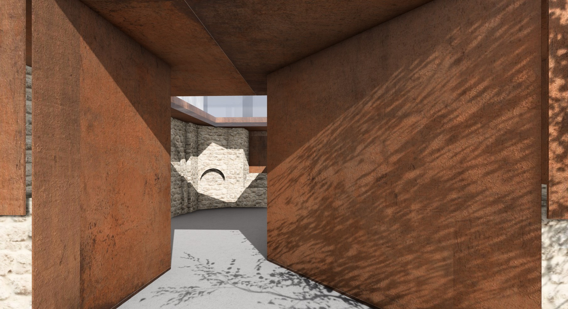
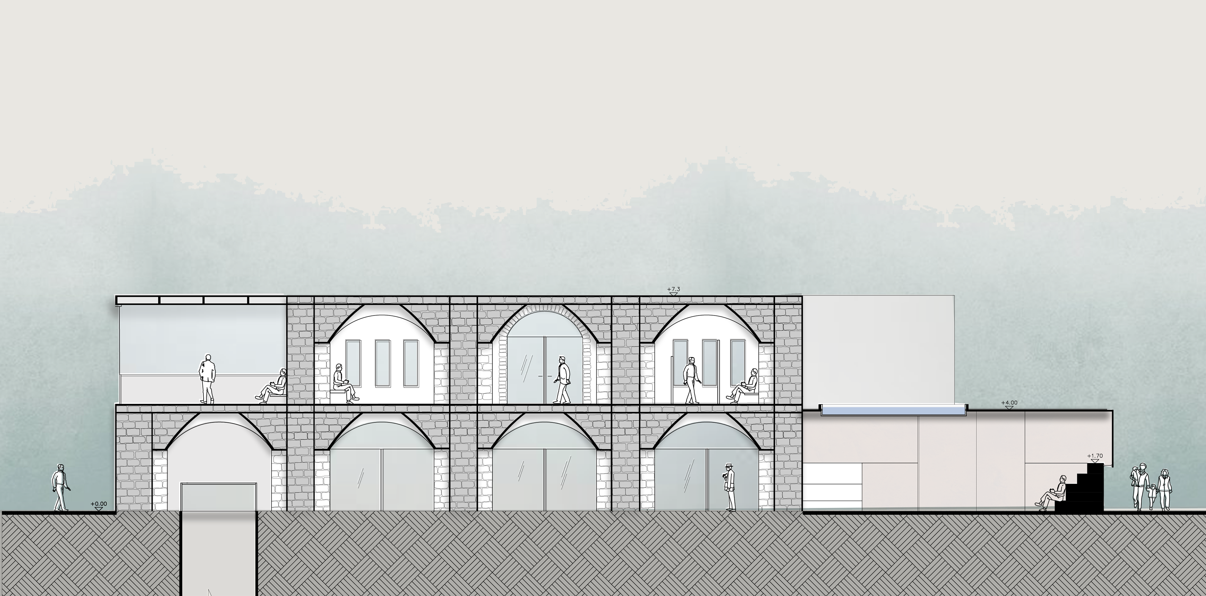
SECTION A-A
The section passes through the Gesher station and Beit Haber. A light rail station for boarding and alighting passengers. The entrance to the bridge is on the second floor through which you can view the entire area and go down one level to the bridge on the first floor that connects to the well house. and a set of stairs and elevators through which you can go down to the ground on both sides of the bridge.
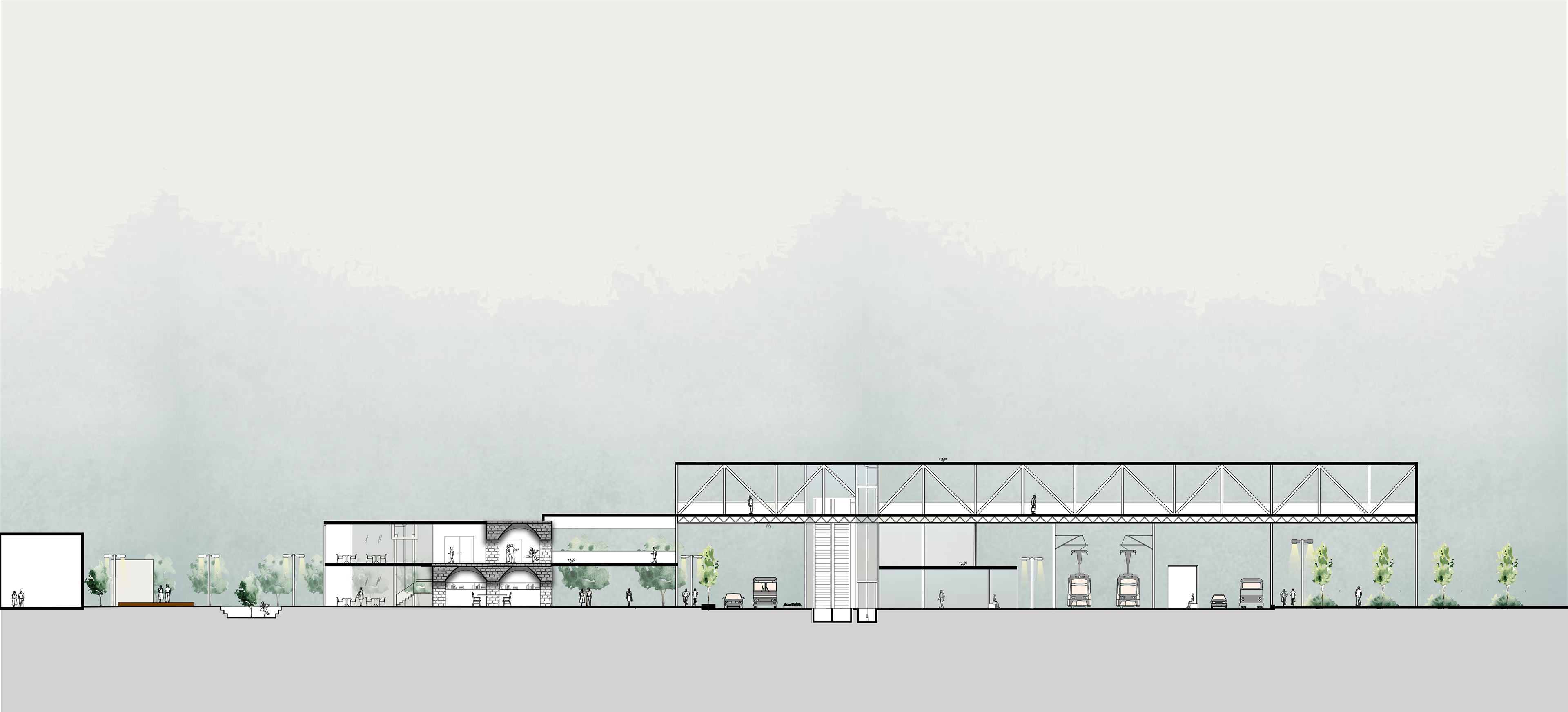
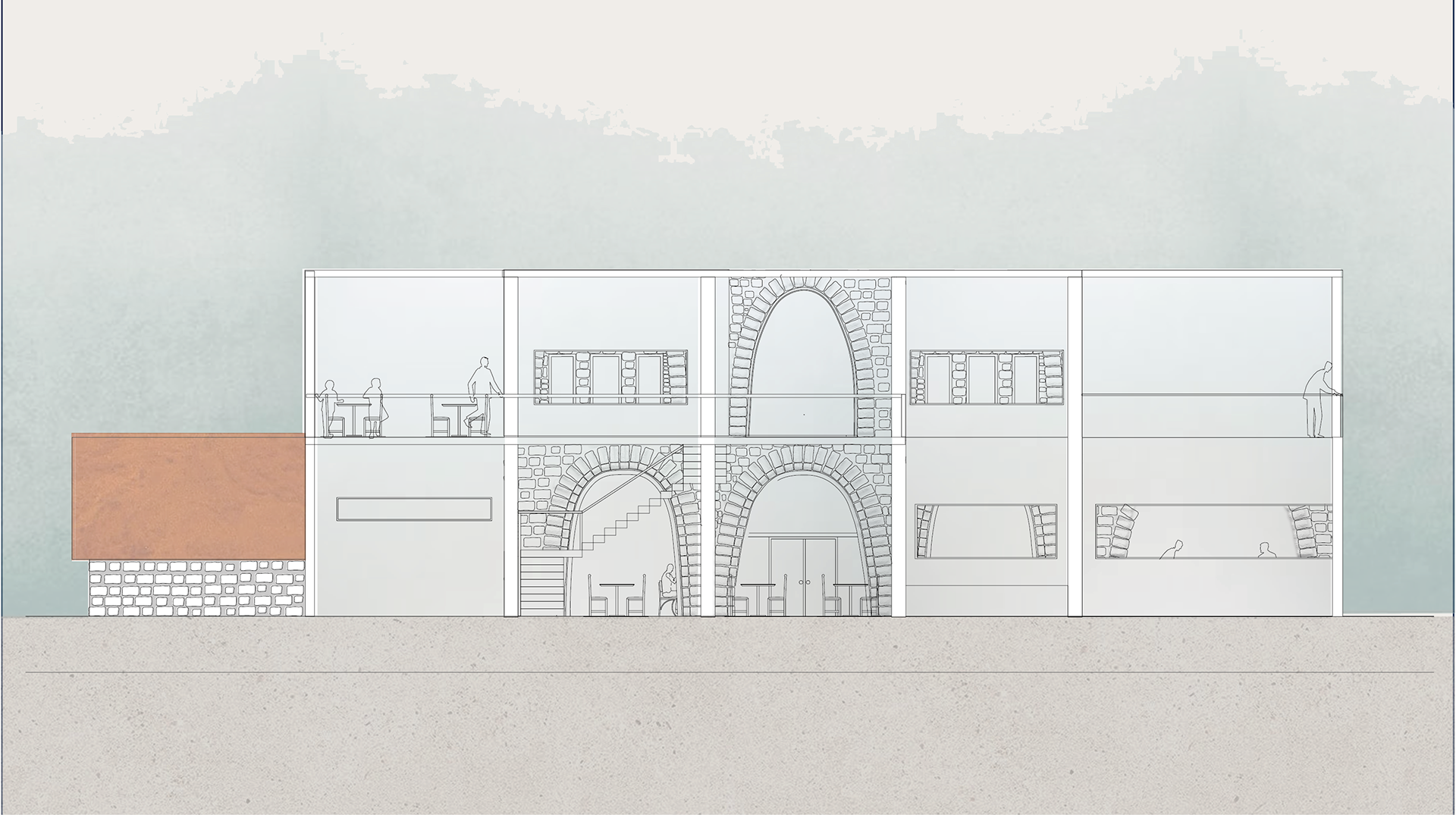
SECTION B-B
The section goes through the Beit Haberl, showing the vaults and closing the arches with glass.